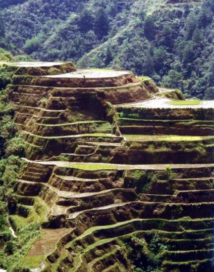
8 Reasons A Trip to the Philippines Should Be In Your Future
by Huffington Post

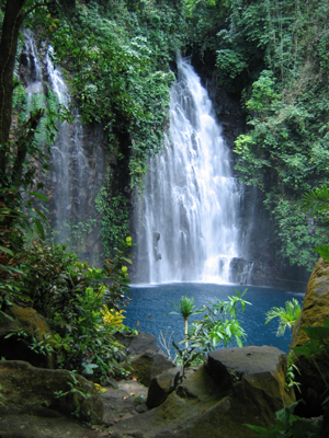
Amazing Waterfalls in the Philippines
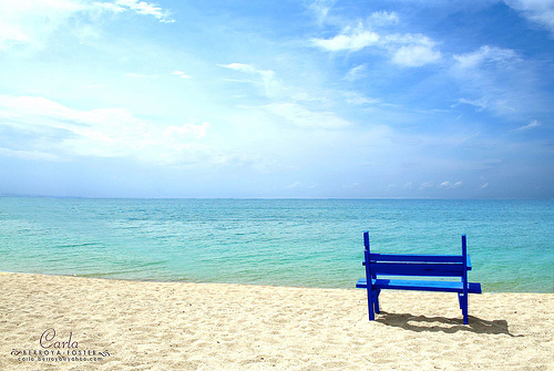
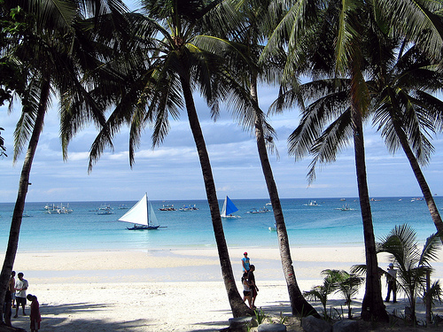
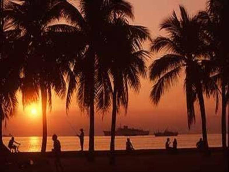
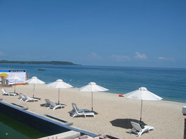
Magnificent Beaches in the Philippines
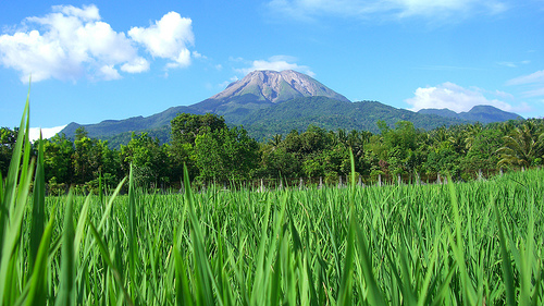
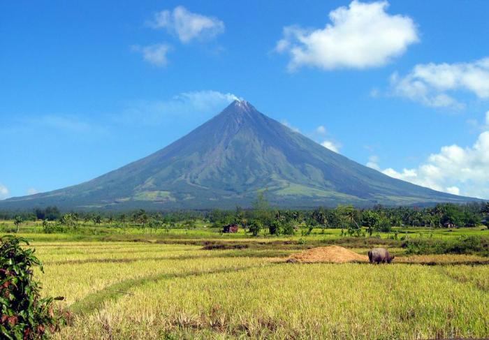
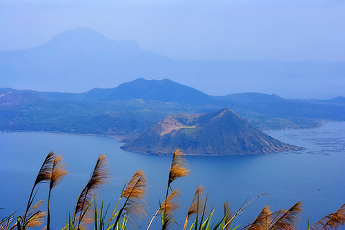
Breathtaking Volcanoes in the Philippines
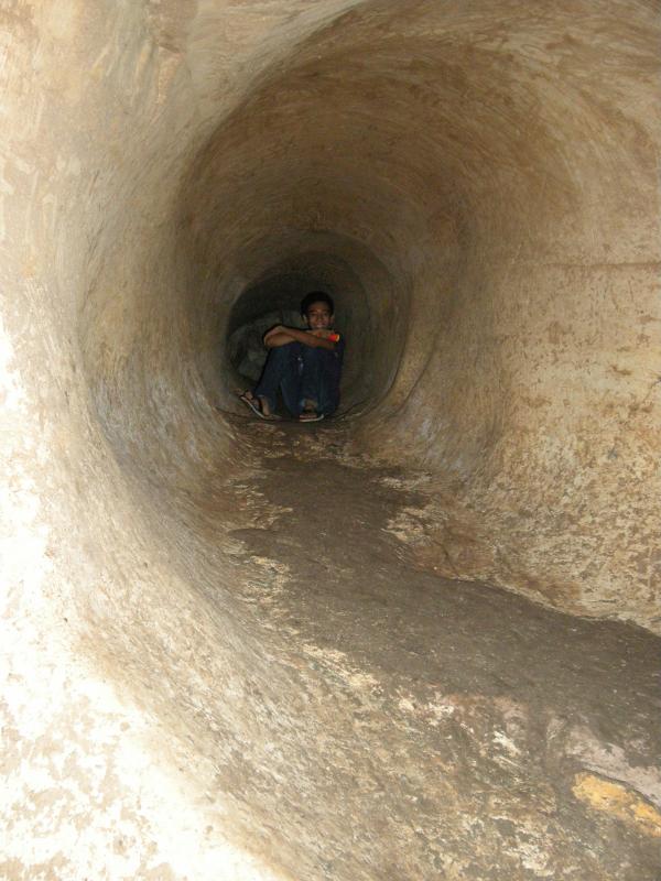
Awesome Caves in the Philippines
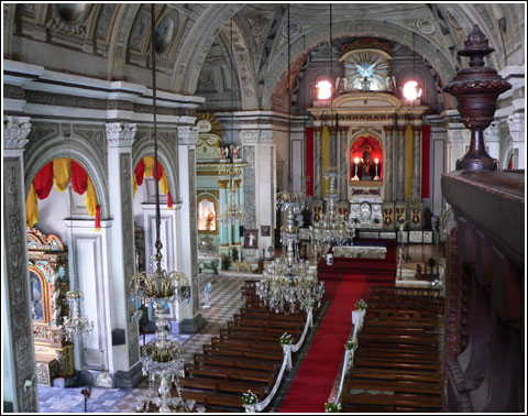
Grand Churches in the Philippines

Colorful and Meaningful Festivals in the Philippines

see more pictures and
videos of the Philippines!

TOURIST SPOTS IN COTABATO
NOTE: North Cotabato (or Cotabato), Cotabato City and South Cotabato are NOT the same.
Cotabato is one of the most stunning provinces in Mindanao. The province has all the best potential tourism sites and they are still untapped and unexploited. Ligawasan Marsh, the snaking Pulangi River, caves, numerous waterfalls, and hot springs are waiting to be discovered. Read More: https://www.vigattintourism.com/tourism/destinations/120
Asik Asik Falls
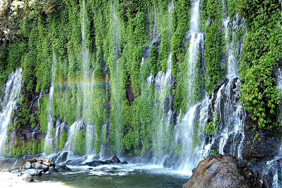 Photo from: http://www.lovemindanao.com/2014/04/asikasikfalls.html
Asik-Asik Falls or Dulao Falls for the locals is situated in Sitio Dulao of Barangay Upper Dado, Alamada, North Cotabato. It is nested in the lower slope of Mount Ragang, also called as Mount Piapayungan or Blue Mountain, an active strato-volcano that sits in the boundary of Lanao del Sur and North Cotabato. There are various tales and side stories of the discovery of this natural wonder. Some say that it was accidentally discovered by military during a clearing operations, while other say that locals already know the place ever since. The latter seems more true and probable, a beauty of such grandeur is impossible to have gone unnoticed. The locals probably just kept it as secret or ignored it thinking it was just a normal scene. Read More: https://www.lakwatsero.com/spots/asik-asik-falls/#sthash.CKS3amEh.dpbs
Batasan Falls
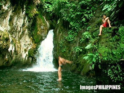 Photo from: http://www.imagesphilippines.com/viewimage.php?id=2180
Visitors from as far as Davao del Sur and neighboring towns explore the hidden treasure that is Batasan Waterfalls in Makilala, North Cotabato. Read More: https://www.gmanetwork.com/news/news/photo/110053/local-tourists-discover-batasan-falls-in-north-cotabato-/photo/
Fort Pikit
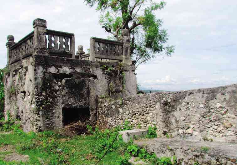 Photo from: http://tingug.com/2018/03/02/kidapawan-was-never-part-of-pikit/?i=1
Fort Pikit was built in 1893 of stone masonry as part of the series of military fortification in Mindanao by the Spanish colonial government. It was used by the American colonial government in 1902 and in 1912-1945. It was occupied by the Japenese Imperial Army and recovered by the American forces in their advancement to liberate Eastern Mendanao during the World War II.
The National Historical Commission of the Philippine had declared Fort Pikit as a National Historical Landmark in March 2012. Read More: http://cotabatoprov.gov.ph/2018/11/26/250/
Indangan Falls
 Photo from: https://chriscian.wordpress.com/2017/10/13/top-destination-in-cotabato/
Indangan Falls, also called Marbel or Marble Falls, are located in Brgy. Indangan near Kidapawan City in Cotabato. They are a hidden twin falls of about 60 to 70 feet in height and are surrounded by hot springs. Read More: https://chriscian.wordpress.com/2017/10/13/top-destination-in-cotabato/
Kansal Falls
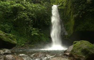 Photo from: https://sites.google.com/site/thekidapawancitysitecom/tourist-spots
Kansal Falls is located at Sitio Lapaan in Barangay Perez. The water from the Kansal Falls is still one of the cleanest and cheapest in Asia and is the source of North Cotabato’s Metro Kidapawan Water District dam.The water rushing through Kansal Falls comes from the various mountain springs in Mt. Apo. This waterfall is the source of Kidapawan City’s water supply. Read More: https://chriscian.wordpress.com/2017/10/13/top-destination-in-cotabato/
Kawa Falls
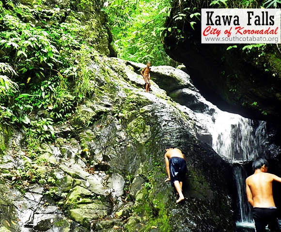 Photo from: http://boyetstour.blogspot.com/2012/11/siok-falls-and-river-trekking-adventure.html#.XV6yb3t7laQ
A 45-minute trail (short cut) or the 3 hours Adventure of a lifetime trail from Pulabato proper, through dirt trails, passing Langub (Amwek Cave), trekking small river pools, rock climbing, trailing through corn fields, going down cliffs, and over seeing some spectacular mountain views until finally getting wet with water fun fun fun in the destination; The Kawa Falls of Brgy Pulabato. Read More: https://www.facebook.com/pg/Tampakan-South-Cotabato-Community-205979759436593/photos/?tab=album&album_id=495572680477298
Lake Agco
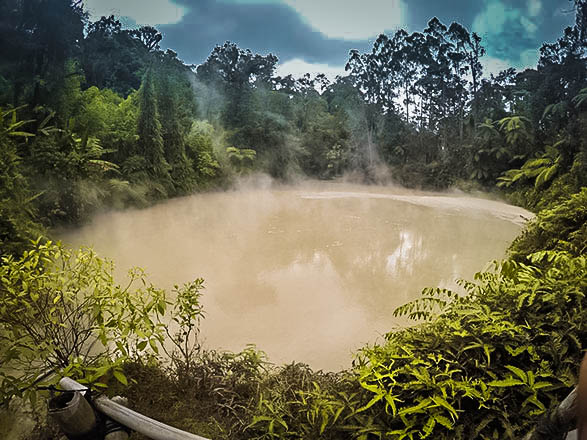 Photo from: http://www.travellingthephilippines.info/lake-agco-resort-kidapawan/
Imagine boiling sulfuric mud and waters heated by the underground volcanic vents from the veins of the grand Mt. Apo gushing out to a mini lake and pools. It’s no “Dante’s Peak movie” scene, rather it’s a haven for nature’s cool and hot baths in the upland forests surrounding Lake Agco.
Dubbed as the Eden of Kidapawan City in North Cotabato, Lake Agco is home to natural lake of boiling sulfuric mud hot mud and water pools which make it a wonderland of cool weather and hot dips!
It was an unexpected return for me to the place that served as my resting ground before and after I completed my first solo guided climb to Mt. Apo in 2011. This time I was with wacky group of obedient office dudes and dudettes who, on one fateful day, decided to travel to breathe fresher air and get some dose of sun in the uplands of North Cotabato. Read More: http://www.nomadperspectives.com/2014/09/fun-in-boiling-mud-lake-agco-kidapawan.html#.XVqrKXt7laQ
Lake Venado
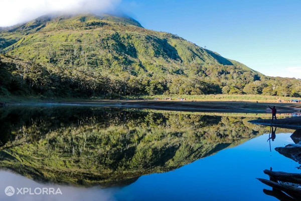 Photo from: https://explora.ph/attraction/707/lake-venado
Lake Venado is located at the foot of Mount Apo in the province of North Cotabato. Mount Apo is the highest mountain in the country with an altitude of 2,954 meters (9,692 feet). It is called the “Grandfather of the Philippines Mountains.”
Lake Venado is an endorheic lake, meaning it doesn’t flow into a sea. In dry season/months, the lake usually loses two-thirds of its size because of evaporation. It is nestled on a plateau, the remains of Apo’s ancient crater. It is the smallest and highest lake in the country with an estimated surface elevation of 7,200 feet above sea level and with a maximum depth of 20 feet. Because of its elevation, the water in the lake is freezing cold which could cause cramps on the swimmer. Swimming in the lake is entirely forbidden. Read More: https://www.vigattintourism.com/tourism/articles/Lake-Venado-The-Mystical-Lake-at-the-Foot-of-Mount-Apo
Liguasan Marsh
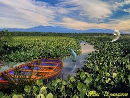 Photo from: http://ph.geoview.info/mt_apo_viewed_from_liguasan_marshland_pagalungan_north_cotabato,66869295p
Liguasan Marsh is a marsh in the Mindanao River basin in the southern island of Mindanao, Philippines.
The marsh covers an area of around 2,200 square kilometers (850 sq mi)[2] spanning the provinces of Cotabato, Maguindanao and Sultan Kudarat. 300 square kilometers (120 sq mi) of this area is reserved for a game refuge and bird sanctury
At least 92 species of birds, dozens of fish species, six species of reptiles and five species of amphibians are recorded to live in the area. The marshland is the only area in the Philippines where the Comb-crested Jacana can be sighted according to the Haribon Foundation. The place is also one of the few places in the country where there are populations of the Philippine crocodile and the Estuarine crocodile, and in the forested area of the march, the Philippine eagle.
Liguasan Marsh is also noted for its natural gas deposit which is estimated to cover a radius of 300 square kilometers (120 sq mi). Read More: https://en.wikipedia.org/wiki/Liguasan_Marsh
Liliongan Cave
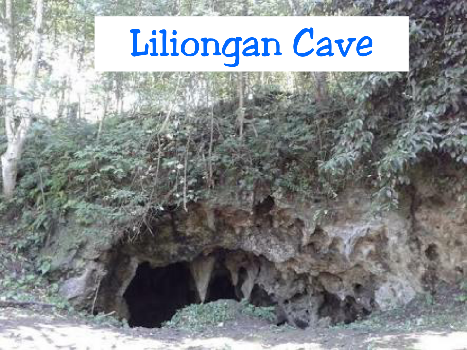 Photo from: http://travelincarmen.blogspot.com/
Liliongan Cave is found in Liliongan, Carmen. It is a natural cave with beautiful stalactite & stalagmites formations inside underground creek & thick layer of guano could also be found inside. Read More: https://beautyofnorthcotabato.wordpress.com/2017/06/25/liliongan-cave/
Mawig Falls
 Photo from: https://sites.google.com/site/thekidapawancitysitecom/tourist-spots
This crystal-clear 65 feet-long waterfalls is located in Barangay Balabag, Kidapawan City, North Cotabato. Mawig falls is one of the pristine park destinations within Kidapawan City area. It is the major source of Matingao River. Read More: http://www.mafi.org.ph/mount_apo_park/eco_park/Mawig_Falls.html
Mt. Apo Natural Park
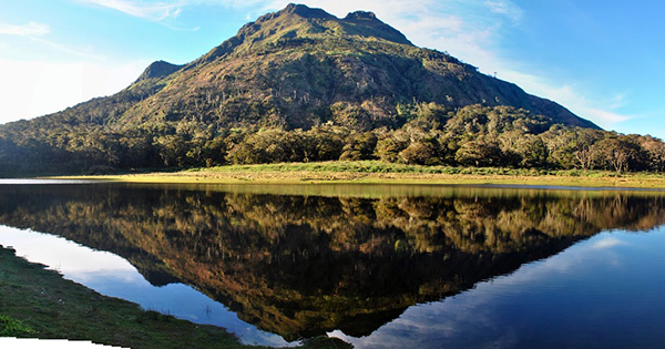 Photo from: https://philippineslifestyle.com/dry-spell-leads-to-1000-trekker-limit-on-mount-apo-during-holy-week/
The Mount Apo Natural Park (MANP), with a total land area of about 64,000 hectares, is located in south-central Mindanao spanning the provinces of North Cotabato in Region 12, and Davao Sur and Davao City in Region 11. With an altitude of 2,954 meters above sea level, it is the highest mountain and one of the most popular nature-based tourism sites in the country. MANP was declared a Protected Area and a component of the National Protected Areas System under Republic Act No. 9237 in 2003.
MANP has great economic significance in the two regions, providing various ecosystem services (e.g., water for domestic use and irrigation, source for energy generation) to 3 cities and 4 municipalities with over 390,000 households. It is inhabited by several indigenous tribes, mainly by Manobos, Bagobos, and Klata. They consider Mt. Apo a sacred mountain and the burial ground of Apo Sandawa, their great forefather. Read More: http://forestry.denr.gov.ph/b+wiser/index.php/sites/mount-apo-natural-park
New Israel Eco Tourism Park
 Photo from: http://cotabato54.rssing.com/chan-7471262/all_p24.html
New Israel Eco-Adventure Tourism Park is located at Barangay New Israel in Makilala and is now one of the top destinations in the province. So if you are looking for an adventure in a noise free place, this is the right place to go as the main attraction of the place is their 2.3 kilometer zipline perfect for adventure seekers. The ziplines are divided into 2 stations (1st station – 1.0 km, 2nd station – 1.3 km). There are also tamed Macaque monkeys around the area that already became part of the community. Read More: http://soulsearchingabs.blogspot.com/2015/01/new-israel-eco-adventure-tourism-park.html
Pisan Cave
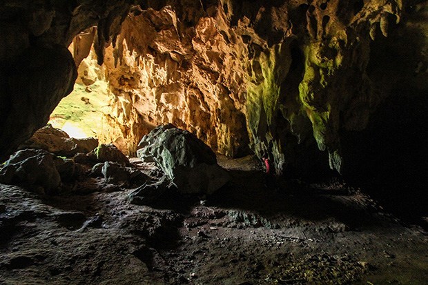 Photo from: https://www.mindanews.com/travel-lifestyle/2014/01/discovering-pisans-hidden-wonders/
Saljay Integrated Farms
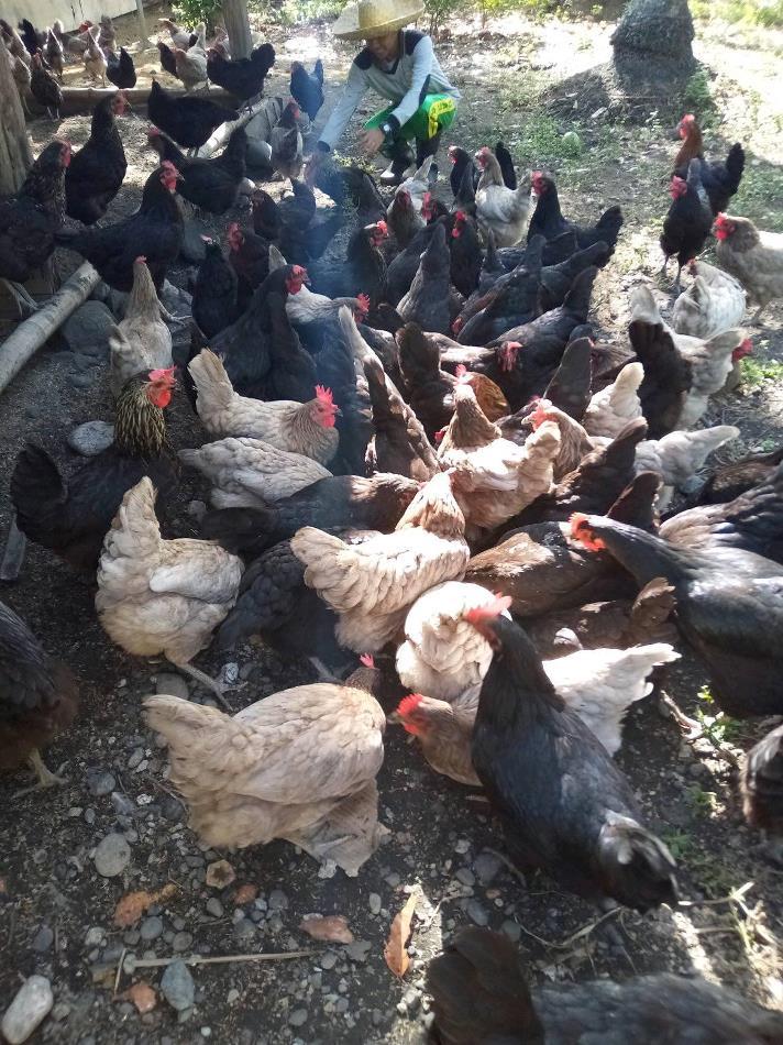 Photo from: https://www.facebook.com/pages/Saljay-Integrated-Farms/402122899837353
Farm tourism yields many economic possibilities, and the enterprising owner of Saljay Farms, 2012 Gawad Saka Awardee Greggy Saljay, certainly knows this. The 8-hectare land in Pigcawayan was originally used to grow only coconut trees. Today, it grows a wide variety of organic produce such as vegetables, herbs, and fruits. The site is also used to grow livestock and poultry. The farm is into vermicomposting and vermiculture, which is the process of using worms to decompose organic food waste and turn it into nutrient-rich material that helps grow healthy and robust plants. With their advocacy of elevating farm tourism in the region, the farm is open to conduct trainings and demos to students, researchers, and other farmers who want to improve their livelihood. Read More: https://explora.ph/attraction/631/saljay-integrated-farms
Tausuvan Falls
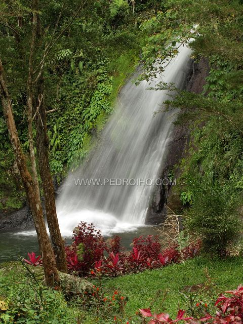 Photo from: https://mindanaoescapades.wordpress.com/2011/02/11/north-cotabato-bongolanon-magpet-tawsuvan-falls/
UK Peak Aleosan
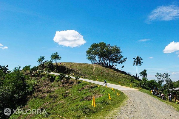 Photo from: https://explora.ph/attraction/690/uk-peak-aleosan
UK Peak, alternatively called The Peak, is located in the remote Barangays of Upper Mingading and Katalicanan (thus the UK name) in Aleosan. The place boasts a scenic 360 view of neighboring towns around North Cotabato.The Peak has its charms with tourists and locals alike. You can do family picnics, kite-flying, barkada get-togethers and people-watching while gazing at the gorgeous setting sun because it is free. Read More: https://beautyofnorthcotabato.wordpress.com/2017/06/25/the-peek-at-uk-peak/
TABLE OF CONTENTS
North Cotabato is Under the SOCCSKSARGEN Region
Where is North Cotabato and How to Get There
Come, Visit and Discover North Cotabato
Popular Tourist Spots in North Cotabato
Colorful Festivals in North Cotabato
How to Have Fun in North Cotabato
North Cotabato Video Collection
Other Visitors Also Viewed:
Enjoy a Sparkling Swim at the Paradise Island Park and Beach Resort
Aguacan Cold Spring in Compostela Valley
Pandayan Festival – Showing Off Ilonggo’s Blacksmith Expertise
Solili Festival is the Celebration of the Day of Siquijor
Wonderful Beaches and Resorts in Bataan
Tongatoc Cove Offers a Breath-Taking View
Itbog Twin Falls Offer Double Fun and Enjoyment
Paadjao Falls – 15 Feet of Cascading Water for a Refreshing Enjoyment