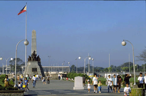
8 Reasons A Trip to the Philippines Should Be In Your Future
by Huffington Post

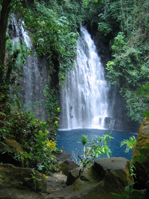
Amazing Waterfalls in the Philippines
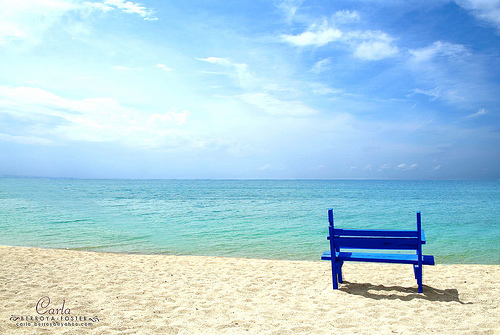
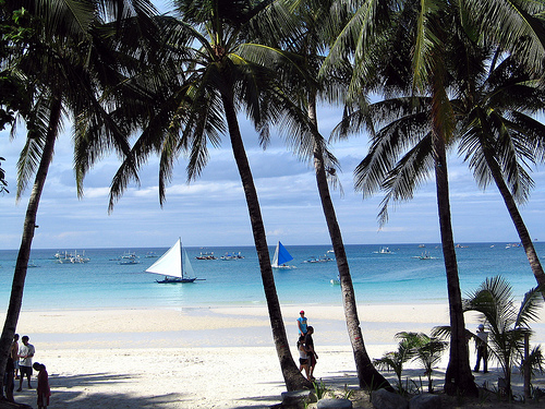
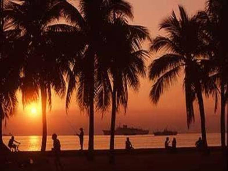
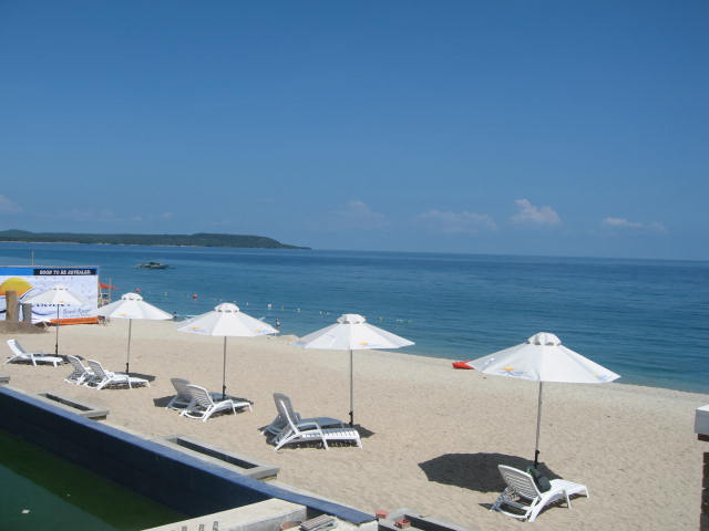
Magnificent Beaches in the Philippines
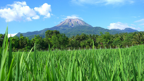
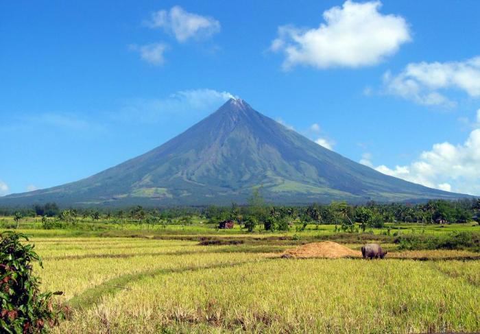
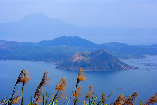
Breathtaking Volcanoes in the Philippines
Awesome Caves in the Philippines
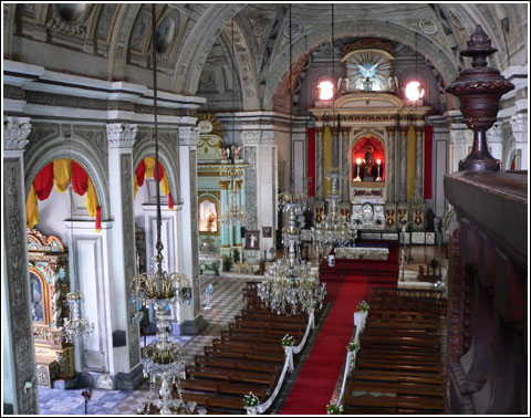
Grand Churches in the Philippines
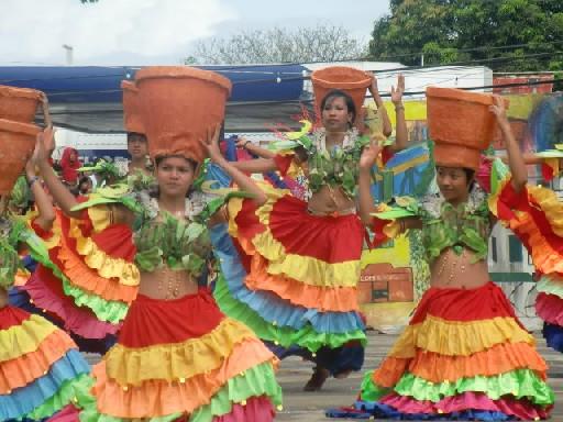
Colorful and Meaningful Festivals in the Philippines

see more pictures and
videos of the Philippines!

SPECIAL PLACES IN BATANES
Batanes is one of the best destination in the Philippines. It’s located in the northernmost province of the country, which is part of the Cagayan Valley region. The provincial capital is Basco, which is the center of commerce and seat of the provincial government.
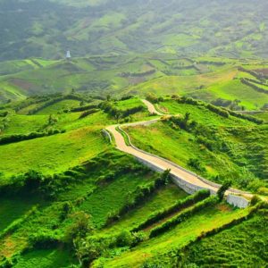 Photo from: https://steemkr.com/nature/@janver06/greenest-country-in-the-north-batanes-philippines
Alapad Hills & Rock Formation
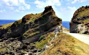 Photo from: https://www.girlchasingsunshine.com/2015/04/photos-that-will-make-you-want-to-visit-batanes.html
The Alapad Hills and Rock Formation is one of the magnificent tourist destinations in the Batan Island. It is a favorite among tourists because it offers a picturesque view of the Pacific Ocean. The hills offer great scenery of the curvy hill while the rock formation will amaze the tourists. Before reaching the destination one will totally enjoy the most scenic road in Batan Island which is the Imnajbu Road Cliffs.
Tourists will certainly love the view of the place and enjoy the tranquility that it offers. Near the Alapad Hills and Rock Formation are other tourist destinations like the Song-Song Ruins, Mahtao Church, Chanarian View Deck, Itbud Village, Uyugan and more. Batan Island of Batanes is truly a wonderful destination to visit. Read More: https://www.vigattintourism.com/tourism/articles/Batan-Islands-Alapad-Hill-and-Rock-Formation
Basco Lighthouse
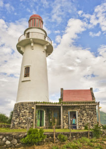 Photo from: https://www.flickr.com/photos/ginggoy/5526145103
Basco Lighthouse is a lighthouse in the town of Basco in Batanes, the northernmost province in the Philippines. Located in Naidi Hills in Barangay San Antonio, the lush green hills and the open sea provide a beautiful backdrop for the lighthouse. The place can easily be reached by a 1.2-km (3/4 mile) hike from the Port of Basco. Read More: https://www.trover.com/d/iWNj-batanes-cagayan-valley-philippines
Basco PAGASA Station / Radar Tukon
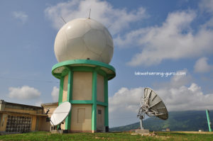 Photo from: https://lakwatserang-guro.com/2015/05/30/a-tour-of-north-batan-part-1/
Why is it called Radar Tukon? Radar = Lighthouse, Tukon = Hill. This facility used to be a lighthouse, and was also used as a United States weather station. Now its a fully functional PAGASA (Philippine Atmospheric Geophysical and Astronomical Services Administration) weather station.
You will get spectacular views of the Basco town, and surrounding hills while at the station. Read More: https://terrifictraveller.com/2016/09/09/batanes-4d3n-for-less/
Batan Island
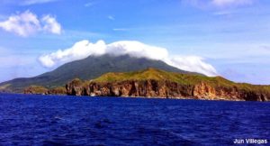 Photo from: http://junvillegas.blogspot.com/2015/04/batan-island-basco-batanes-tour-south.html
Batan Island is the major island of Batanes where it’s capital, Basco, is located. It is also the primary entry point to all major islands in Batanes mainly because of the population and the existence of a fairly-sized airport. Popularly known for it’s green pastures and lush green Marlboro hills, the beautiful cliffside landscapes, and picturesque lighthouses, Batan Island welcomes you to a new horizon of seeing things. Batanes will always break your heart, so be prepared for the pain when you leave it. Read More: http://rediscover.ph/2017/01/batan-island/
Bunker’s Café
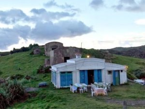 Photo from: https://www.thecrazytourist.com/15-best-things-batanes-philippines/
Bunker’s Cafe is one of the many popular restaurants in Batanes, but it is open only during the peak tourist months from October to June.
Chamantad-Tiñan Cove
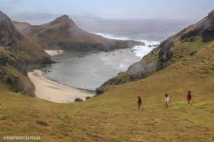 Photo from: https://www.thepoortraveler.net/2014/06/basco-batanes-tour-resort-rental-budget-guide-philippines/
If Mahatao has its Racuh-a-Payaman, Sabtang has its Chamantad-Tiñan View Point. This is the place where you can actually see some Ivatans lend their Kanayi and Vakul for picture taking purposes with the great landscape in your background. A short walk from the dusty road led us to the peak of the viewpoint that offers a panoramic view of the coast.
From that point, we saw a shallow sparkling water on a cove, and we didn’t dare to miss it. After messing up with the slope of the hill, we safely got down on the little cove. Pebbles and small to medium-sized rocks allied on the short strip of beach. Read More: http://www.rjdexplorer.com/secrets-of-sabtang-island-batanes/
Chanarian Beach
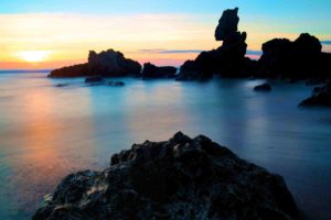 Photo from: https://www.dphotographer.co.uk/image/238193/kingdome_come
For sunset, one good spot is the Chanarian beach, a few minutes away from town proper of Basco. It’s a long stretch of light black sand and pebble beach suited for refreshing dips and sunset viewing. What makes it unique is the interesting stone stacks near the beach. Read More: http://www.choosephilippines.com/go/islands-and-beaches/2042/15-must-visit-spots-batanes-eric-banes
Chanarian View Deck
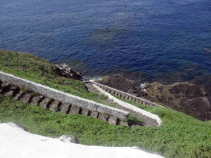 Photo from: http://www.pinoyroadtrip.com/2012/07/half-day-cultural-heritage-tour-of.html
Batanes has always been compared to Ireland when it comes to its cliffs. Though I myself haven’t been there, I know a couple of friends who has been there and had told me that the Cliffs of Batanes does remind them of Ireland. When in tour in Batanes, one of the favorite stops along the road is the Chanarian Viewdeck where you can have a closer inspection of the cliffs.
Chanarian Viewdeck is just a short drive south west of Basco before you enter the town of Mahatao. Just between the zigzagging road of Hanib and Mahatao. You wont miss the cemented view deck and benches on your right coming from Basco.
There are cemented stairs going down the cliffs. A lot has been damaged though so it is best to be careful when going down as some of the rocks and cemented steps are loose. Read More: https://www.ironwulf.net/2008/08/15/batanes-cliffs-of-chanarian/
Chadpidan Beach
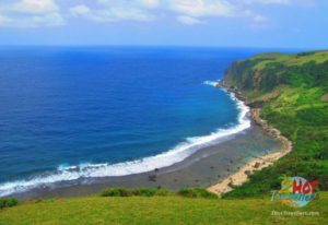 Photo from: http://www.2hottravellers.com/pebble-beaches-philippines/
On the western edge of Batan Island is its twin, Chadpidan Beach. Like Valugan, it is filled with boulders that were spewed by the nearby Mt. Iraya centuries ago and were eventually polished and smoothed by the tides and the monstrous waves of the West Philippine Sea (South China Sea). Chadpidan means “west” in the Ivatan language; Valugan means “east.”
Chadpidan Beach is just a tricycle or motorcycle ride away from Basco Airport or town proper. Bicycles are also available. This may also be included in some North Batan tours. Simply tell your guide that you want to see Chadpidan Beach too. Read More: https://www.philippinebeaches.org/chadpidan-boulder-beach-batanes-tour-rates/
Chavayan Church
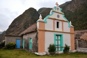 Photo from: http://www.rjdexplorer.com/secrets-of-sabtang-island-batanes/
This church in Chavayan is also known as Sta. Rose de Lima Chapel. Chavayan is the town which has the best preserved stone houses commonly found in the province of Batanes.
Chavayan Village
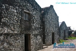 Photo from: http://journeyingjames.com/2011/05/batanes-snapshots-from-sabtang-island/
The tiny Chavayan Village is located on Sabtang Island, part of the Batanes region of the Philippines and permanently locked in ages gone by. There is only one road in and out of the village, which is nestled on a thin strip of land between the mountains and the sea. Read More: https://theholidaze.com/chavayan-village-sabtang-island-batanes/
Chawa Viewdeck
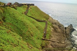 Photo from: http://www.batanes.gov.ph/basco/
The view deck is located at the island of Mahatao facing the West Philippine Sea, making this an ideal spot for sunset watching. It offers a magnificent view on the island’s coastline characterized by sea waves smashing the cliffs. This is also the perfect place to relax and enjoy the breeze of the wind blowing from the sea with the sight of the clear blue sea. Climbing back up is not for the faint of knees though. Read More: http://www.academicroom.com/article/do-you-want-know-top-7-tourist-destinations-batanes-you-shouldn%E2%80%99t-miss
Di-Atay Beach
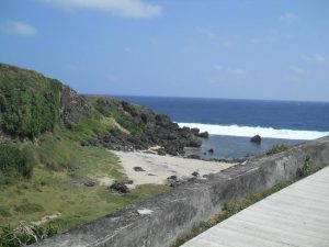
Di-Atay Beach is located in Mahatao, Batanes, is a beautiful cove with multi-colored rocks and white sand ideal for picnics and beach combing. Located along the highway of Mahatao, it is 9.85 kilometers from Basco. Read More: https://greedypeg.org/batanes/Di-Atay-Beach.html
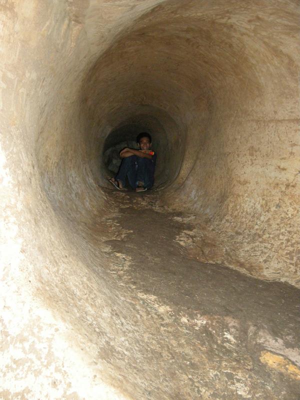
Dipnaysupuan Japanese Tunnel
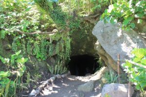
Dipnaysupuan Japanese tunnel is an interconnected network of tunnels in Tukon Hills, Basco, Batanes, the Philippines. It served as a shelter for the Japanese imperial forces during the Japanese occupation in the Philippines until the end of World War II.
Because of its strategic location, the Japanese imperial forces forced the Ivatans to dug tunnels in Tukon Hills for their shelter. The Japanese soldiers spent years hiding in these tunnels until the end of Word War II. Read More: https://intrepidwanderer.com/2014/03/inside-the-dipnaysupuan-japanese-secret-tunnels/#.W93lC-JRdaQ
Disvayangan Beach
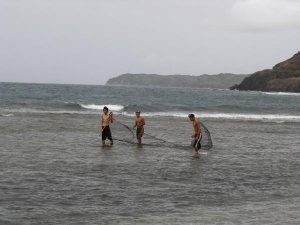 Photo from: https://www.travelblog.org/Photos/1177829
Diura Fishing Village
 Photo from: https://www.ironwulf.net/2017/06/18/batanes-diura-fishing-village/
But my favorite destination in Mahatao is Diura Village, located just below the promontory where Tayid Lighthouse is standing. It is largely known for its traditional fishing practice for arayu (Dorado). During the fishing season which falls on summer, here lives an association of fishermen called Mataw. Cardona tells me that these locals have permanent homes in Matao town proper, so the cogon houses standing shoulder to shoulder at the shores of Diura Village are actually temporary houses. Read More: https://www.thepinaysolobackpacker.com/batanes-mahatao-trip-blog/
Duvek Bay
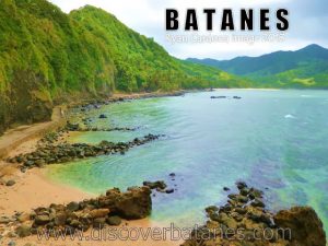 Photo from: http://www.discoverbatanes.com/2013/11/
Chavayan and Sumnanga are neighboring villages but there are no paved roads connecting the two and a mountainous part separates them. We needed to loop around the island just to go to Sumnanga. Houses here are more compressed than the other villages which mean a tighter community.
On the rear part of the village is the place they called as Duvek Bay. As per our guide, it is a site of the most pristine coral conditions in Batanes. Sumnanga is also tagged as the Little Hongkong of the province. Read More: http://www.rjdexplorer.com/secrets-of-sabtang-island-batanes/
Fundacion Pacita
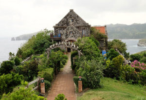 Photo from: https://www.philstar.com/nation/2017/06/07/1707637/batanes-declared-drug-free-province
If you are looking for higher-end accommodations in Batanes, the Fundacion Pacita Batanes Nature Lodge is a good option.
Located farther away from the town proper, this former residence of international Filipino artist Pacita Abad set atop a hill offers dramatic views and cozy accommodation. Read More: http://www.ilink.ph/fundacion-pacita
Homoron White Beach
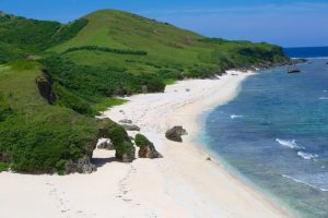 Photo from: https://thestylerandomguy.com/2018/02/24/ultimate-travelgoals-2018-philippines/
Homoron White Beach (or simply, White Beach) is one of beaches lacing Batan Island whose waves are a bit friendlier and gentler to swimmers. This short strip of sand and shingles is a popular picnic area for both locals and tourists. Framed by rocky cliffs on both sides and serenaded by the constant humming of the waves, it is an untouched slice of tropical pulchritude in this side of Batanes. Read More: https://www.philippinebeaches.org/homoron-white-beach-mahatao-batanes/
Homoron Blue Lagoon
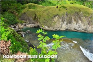 Photo from: http://www.findinghenru.com/homoron-blue-lagoon/
Honesty Coffee Shop
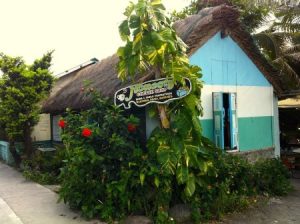 Photo from: http://katewashere.com/2015/07/honest-cafe-98-honest-since-1995/
Honesty Coffee Shop isn’t your ordinary cafe. It is unmanned and always open, allowing the customers to get what they need and trusting that they do the right thing and pay right. Yep, you just get what you want and drop your payment at designated boxes.
Owned by married couple Jose and Elena Gabilo, the Honesty Coffee Shop has become a tourist spot on its own. It is located just beside the Port of Ivana, the jump-off point to Sabtang Island.
It was a bitter pill to swallow too. Has honesty been so scarce, so rare? There is sadness in realizing that most of us find honesty odd and refreshing enough to be a tourist attraction. Read More: https://www.thepoortraveler.net/2014/04/honesty-store-coffee-shop-ivana-batanes-philippines/
House of Dakay
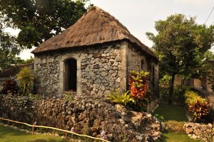 Photo from: https://reggiemateo.wordpress.com/2013/05/16/the-oldest-stone-house-of-batanes/
The House of Dakay – believed to be the oldest stone house in the province (also the most photographed house in the island province). It is now considered a UNESCO-inscribed treasure. This stone-made abode is an epitome of time-tested strength. The thick walls are made of thick stone and lime. The roofs are made from cogon grass about 1/3 of a meter thick. Read More: https://nojuanisanisland.com/2015/07/23/ivana/
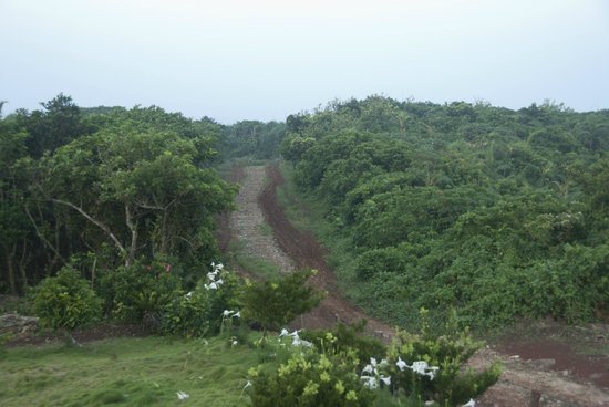
Imnajbu Road Cliff
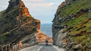 Photo from: https://www.preview.ph/culture/these-are-the-spots-in-batanes-you-have-to-see-a00192-20180408
Imnajbu, which means to settle in the lowlands, is the place where the first mass baptism in the islands was held. The road to Imnajbu is filled with rough cliffs and interesting rock formations, which includes what is now popularly known as the Alapad Pass. Imanjbu Road Cliffs offer visitors a clear, breathtaking view of the Pacific Ocean.
The Imnajbu Road Cliffs are located 16 kilometers Southeast from Basco. Read More: http://www.zeotrip.com/attraction/philippines/batanes/imnajbu-road-cliffs/
Itbayat Airport
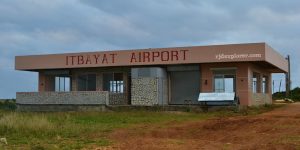 Photo from: http://www.rjdexplorer.com/the-journey-to-the-northernmost-inhabited-island/
It’s also possible to travel to Itbayat by plane from Basco. NorthSky Airlines is an 8-seater plane that travels every Monday, Wednesday and Friday. Elite Aviation (which started operating just April 19, 2014) is a 5-seater plane that offers daily flights. Fare for both planes cost in the range of P1,800 for a one way trip that will take 10-12 minutes long. Both aircrafts will only fly if there are enough passengers to fill all the seats. The Itbayat airport is an hour away from the town proper by land. Read More: https://www.traveling-up.com/travel-guide-itbayat-batanes/
Itbayat Burial Caves
 Photo from: http://www.rjdexplorer.com/the-journey-to-the-northernmost-inhabited-island/
Burial sites from the ancient settlements can also be found here. There were about 7 burial mounds there shaped like a boat pointing to the sea. Some are already hard to distinguish from the regular rocks and the remains were no longer found there. The seafaring Austronesians believed that these boat-shaped graves would lead their departed spirits to the other life safely. Read More: https://www.ironwulf.net/2012/06/25/batanes-torongan-cave-hills-itbayat-island/
Itbayat Island
 Photo from: http://www.manilaoldtimer.net/Travels/Itbayat.html
For first-time visitors, Itbayat Island may seem like a place suspended in time. An island paradise barely touched by the unrelenting hand of modernization, Itbayat is one of the last regions of the Philippines where man has hardly left his mark on the environment.
It is a place that sometimes feels foreign and wild, yet at the same time, familiar and tame, a place of majestic rolling hills where wild horses roam freely, racing across open fields. It’s also a place forgotten by history, where vast cave systems hold the secrets to some of the Philippines earliest settlers.
If you’re up for a real adventure and want to experience untouched nature, Itbayat is the perfect destination. Read More: https://www.ourawesomeplanet.com/awesome/2017/04/itbayat-island-philippines-last-frontier.html
Itbayat Lake
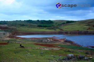 Photo from: http://www.escapemanila.com/2014/02/DIY-Batanes-Travel-Guide.html
Itbayat Sta. Maria Church
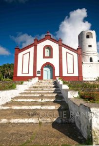 Photo from: http://lagalog.com/2010/07/itbayat-catching-glimpse-of-simple-life.html
Don’t leave Itbayat without dropping by the Sta. Maria Imaculada Church located at the heart of the town. The church was built by Father Vicente Araujo from 1853 to 1858. The façade of the church is simple yet it has a unique charm that made me consider it as the best church in Batanes. I wasn’t able to check out the interior of the church since no one was available in the area that time and all doors were closed. Read More: http://www.rjdexplorer.com/the-journey-to-the-northernmost-inhabited-island/
Itbud Idjang
One of the 4 Idjangs in Batanes. In here, rock carvings are still evident (probably for water storage), as well as their gathering/meeting area and the rocks with bored holes for anchors are still intact. Read More: https://iamaileen.com/batanes-things-to-do-diy-itinerary-5-days-sabtang-itbayat-travel-guide/
Ijangs are citadels built on mountaintops, as you can already guess from the title. These are made approximately 4,000 years ago, the time of Austronesian migration to northern Philippines. Pre-Hispanic Ivatans, the indigenous dwellers of the Batanes Group of Islands, shaped and carved the mountains to accommodate their population’s needs.
Ijangs were primarily used as fortifications and settlements. Early civilizations in Batanes were characterized by frequent wars among different villages, so settlers sought refuge in these strongholds when they were attacked by enemies. Some of these fights would last for a long period of time, requiring the inhabitants to make their own dwellings on the mountaintops. Aside from internal conflicts between tribes, it is also theorized that outside threats were one of the reasons why ijangs were built. Read More: https://www.vigattintourism.com/tourism/articles/Ijangs-Mountain-Fortresses-of-Batanes
Ivana
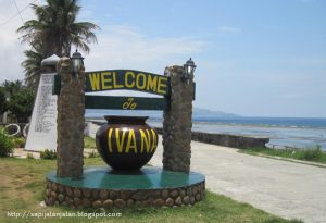 Photo from: https://sapijalanjalan.blogspot.com/2011/09/philippines-may-2011-part-5.html
Liveng – the Batanes Hedgerows
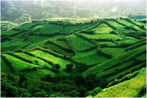 Photo from: http://www.zeotrip.com/attraction/philippines/batanes/liveng-batanes-hedgerows/
One thing that would grab your attention when you look at the hills on the island are this complex network of tall vegetation that seems like boundaries of a giant jigsaw puzzle spread over the verdant hills. Liveng to the locals, are small trees, tall grass like talahib, bamboo, shrubs and/or corn that are planted to serve many purposes: protection of crops against grazing animals, windbreakers, protection from soil erosion and serves as boundaries or demarcation lines of the lands they own. Read More: https://banebanerbanest.wordpress.com/2014/09/03/15-must-visit-spots-in-batanes/
Mahatao Port and Boat Shelter
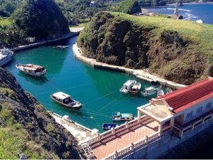 Photo from: http://hamsternice.blogspot.com/2015/11/instagram-images-philippine-provinces2.html
The Mahatao Boat Shelter (or just Port Shelter). This is becoming an iconic landmark in Batanes. This is where inter-island boats, and vessels dock during stormy weather. Since fishing is one of the main industries in Batanes, (and since Batanes is frequented by strong typhoons), it paved way for the construction of this boat port as a means of supporting the industry and the provision of local employment. Read More: https://nojuanisanisland.com/2015/06/28/breathtaking-batanes-mahatao-philippines/
Mahatao Tayid Lighthouse
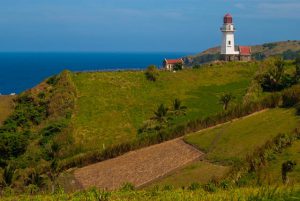 Photo from: https://www.thepinaysolobackpacker.com/batanes-mahatao-trip-blog/
Situated in Mahatao, Batanes is the “Tayid Lighthouse”, it is one of the three functional lighthouse that was built in early 2000s. The lighthouse also serves as a tourist attraction.Many people think that the Tayid lighthouse is the 18th century old Mahatao Lighthouse but it is not the Spanish-era lighthouse.
The construction of Tayid lighthouse together with Basco and Sabtang lighthouse was important because they serve as indicators to seafarers across the risky waters of West Philippine Sea and Pacific Ocean. Read More: https://www.vigattintourism.com/tourism/articles/Captivating-Tayid-Lighthouse-of-Mahatao-Batanes
Mahatao Viewdeck
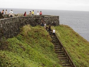 Photo from: https://www.travelblog.org/Photos/1177800
Mahayaw Arch
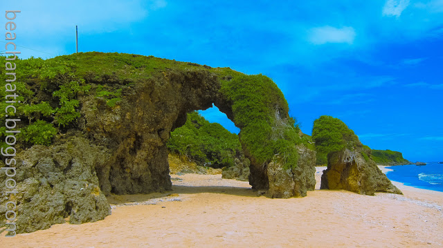 Photo from: https://beachanatic.blogspot.com/2016/03/the-northernmost-province-of-batanes_8.html
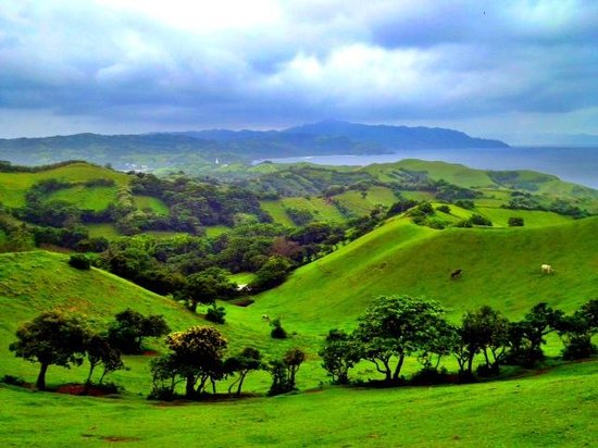
Marlboro Country/ Racuh A Payaman
 Photo from: https://www.facebook.com/MarlboroCountryBatanes/posts/d41d8cd9/1839864099620900/
Mavudis Island
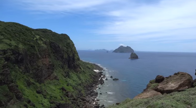 Photo from: https://news.mb.com.ph/2018/06/18/engineering-works-for-fishermens-shelter-in-mavulis-island-continues/
Morong Beach
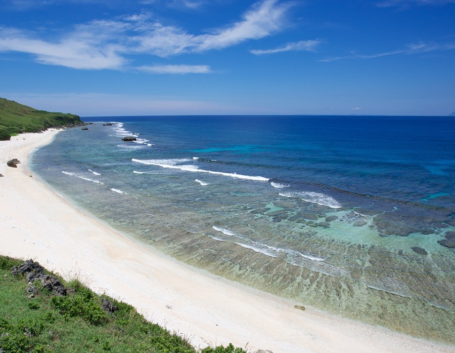 Photo from: https://touristspotsfinder.com/photos-morong-beach-in-batanes/
Mt. Carmel Chapel
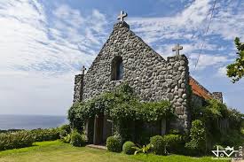 Photo from: https://www.vigattintourism.com/tourism/articles/Mt-Carmel-Chapel-The-Church-of-Fullfilled-Dreams
Mt. Matarem
Mt. Iraya
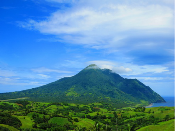 Photo from: https://mtiraya-usjr.weebly.com/
Mount Karoboboan
Naidi Hills
Nakabuang Arch
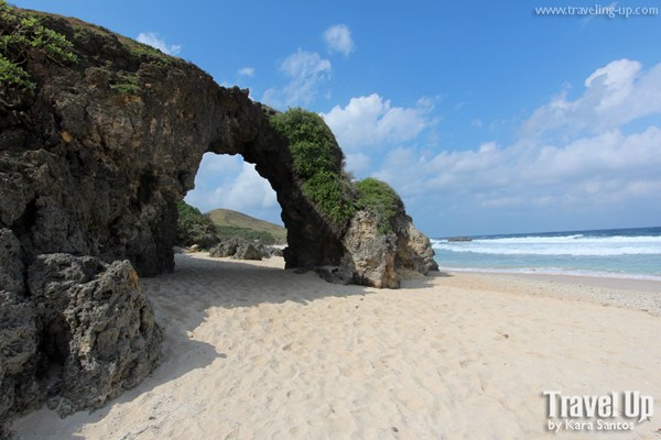 Photo from: https://www.traveling-up.com/travel-guide-sabtang-island-batanes/
Ranum ni Kumalakal /
Rakuh-a-idi (Spring of Youth)
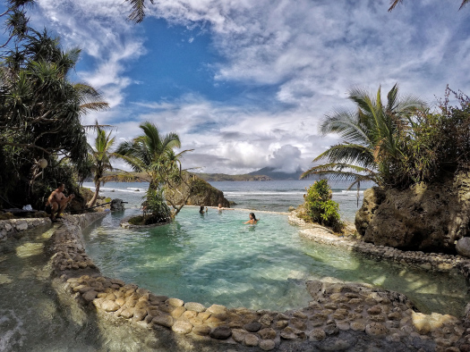 Photo from: https://ianthebrave.com/2019/01/05/sabtang-fountain-of-youth/
Sabtang Beach
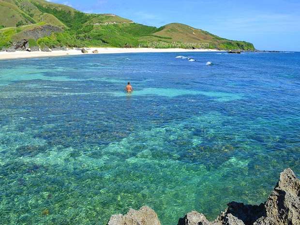 Photo from: https://www.choosephilippines.com/go/islands-and-beaches/1484/sabtang-island
Sabtang Lighthouse
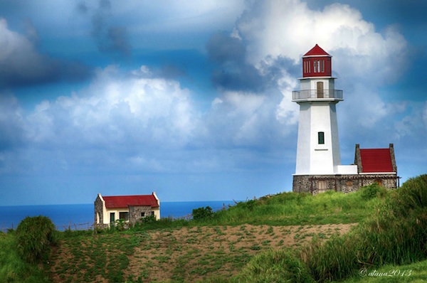 Photo from: http://pinayphotography.blogspot.com/2013/06/breathtaking-batanes.html
Sabtang San Vicente Ferrer Church
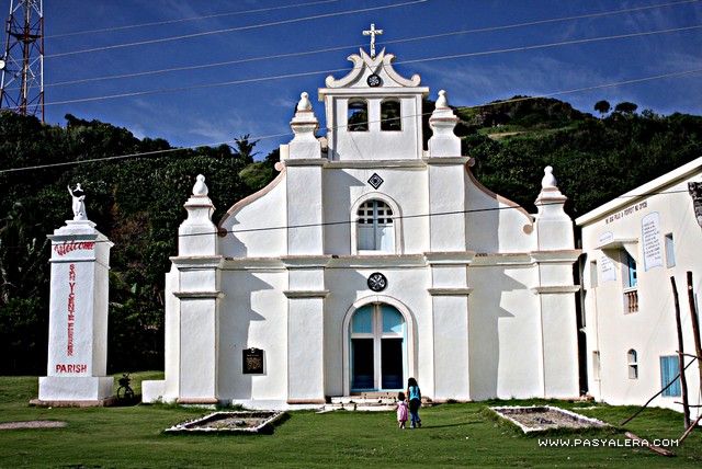 Photo from: https://www.pasyalera.com/batanes/sabtang-island-batanes/
Savidug Stone Houses
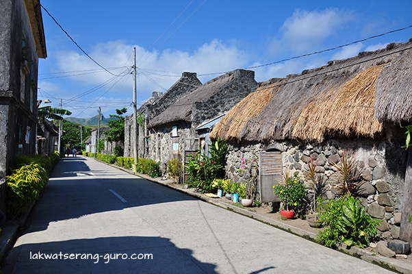 Photo from: https://lakwatserang-guro.com/2015/05/31/sabtang-island-part-1-the-sinakan-stone-houses/
Siayan Island
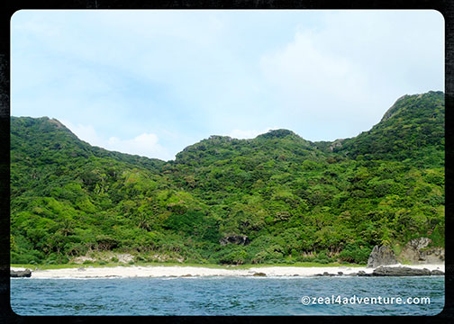 Photo from: https://zeal4adventure.com/2012/08/31/siayan/
Songsong
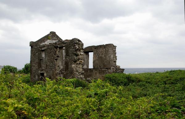 Photo from: https://www.vigattintourism.com/tourism/articles/Songsong-in-Chadpidan-BayRuins-of-Songsong
Spanish Bridge
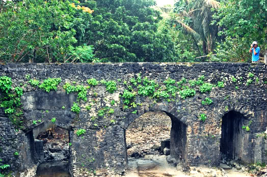 Photo from: http://www.pinaytraveljunkie.com/batan-island-batanes-old-spanish-bridge-and-house-of-dakay/
Tayid Lighthouse
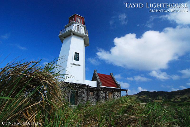 Photo from: https://www.vigattintourism.com/tourism/articles/Captivating-Tayid-Lighthouse-of-Mahatao-Batanes
Turungan Cave
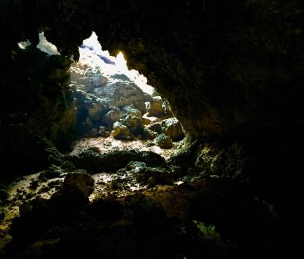 Photo from: https://mapleleafsuncom.wordpress.com/2017/03/26/why-i-will-never-forget-itbayat-island-batanes/
Tinian
Tukon Church
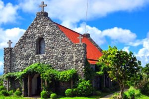 Photo from: http://philippinesplace.blogspot.com/2012/03/tukon-chapel.html
Valugan Boulder Beach
 Photo from: https://www.philippinebeaches.org/valugan-boulder-beach-batanes-tour-rates/
Vayang Rolling Hills
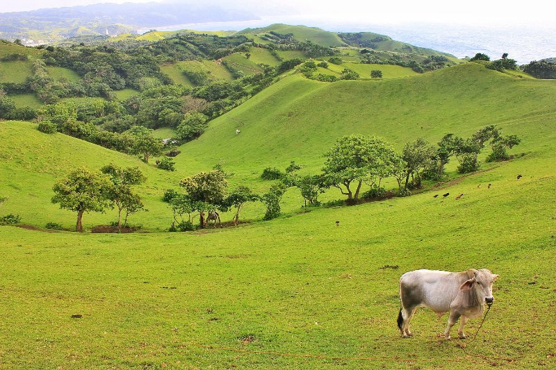 Photo from: https://www.travelblog.org/Photos/7560703
Vujus Island
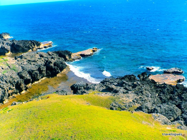 Photo from: http://www.matetreyes.com/2015/06/i-left-my-heart-and-soul-in-batanes_23.html
TABLE OF CONTENTS
Batanes Forms Part of Region II
The Enthralling Tiny Islands of Batanes
Where is Batanes and How to Get There
Special Places to Visit in Batanes
Batanes Photo Gallery
Batanes Video Collection
Other Visitors Also Viewed:
Savor the Beauty of the Island Paradise of Camiguin
The Awesome Calaguas Group of Islands
Join the Abaca Festival in Catanduanes
Special Events and Festivals in Aurora
The “Halamanan” Festival in Bulacan is a Celebration of Plants, Flowers and Trees
See the Mystical Bathala Multiple Caves in Marinduque Part 2
The Marble-Rich Province of Romblon
Discover the Amazing Beaches of Camiguin
Hudyaka Festival is Celebrated with Plenty of Merry Making