8 Reasons A Trip to the Philippines Should Be In Your Future
by Huffington Post

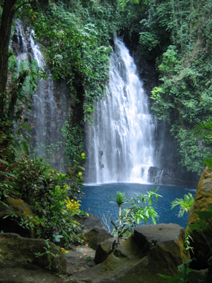
Amazing Waterfalls in the Philippines
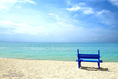
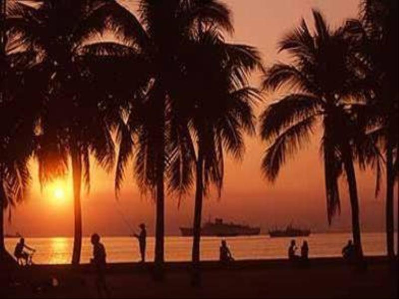
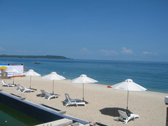
Magnificent Beaches in the Philippines
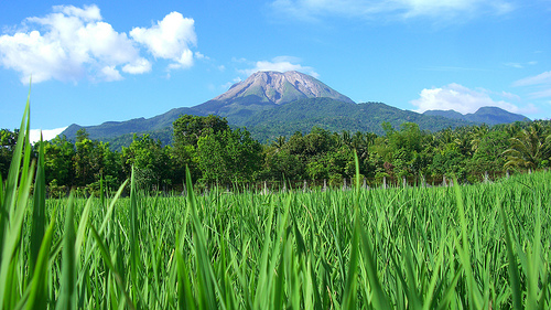
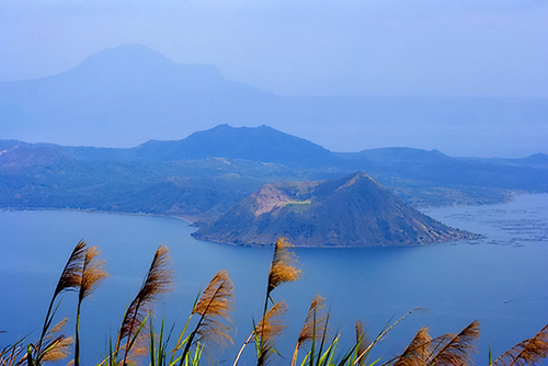
Breathtaking Volcanoes in the Philippines
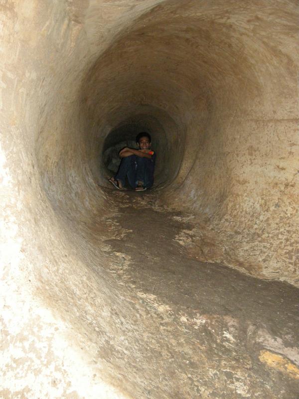
Awesome Caves in the Philippines
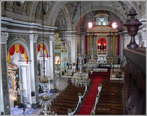
Grand Churches in the Philippines
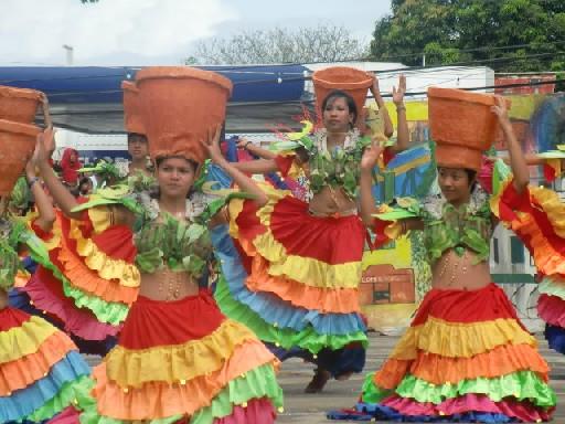
Colorful and Meaningful Festivals in the Philippines

see more pictures and
videos of the Philippines!
Archive for the ‘Laguna’ Category

ATTRACTIONS IN SIERRA MADRE
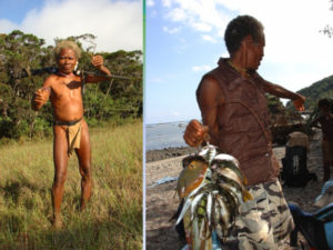 Photo from: https://ebonph.wordpress.com/2013/01/04/philippine-crocodile-conservation-in-isabela-province/
The Philippines is one of the world’s most diverse countries due to its exceptional concentration of endemic species. Unfortunately it is also able to claim one of the world’s highest threats to endemism from habitat loss. Irrespective of legislation, illegal logging continues to threaten biodiversity. A haven for this rich biodiversity is the Sierra Madre Mountain Range. Still retaining primary forest and home to much of the endemic genera, this range is a key biodiversity corridor in the northern reaches of the Philippines. Stretching across the eastern side of the Northern Island, Luzon, it encompasses a large number of protected areas. The largest of which is the Northern Sierra Madre National Park (NSMNP).
Connecting to the north of the NSMNP is the Peñablanca Protected Landscape and Seascape (PPLS), forming a large expanse of protected rainforest. Within each resides communities of Indigenous people, including the Agta, Itawes, Ibanags, Ilocano, Tagalog Pampanguenos and Visaya, concentrated primarily around the narrow coastal strip. Read More: http://www.changingfields.com/expeditions/philippines-northern-sierra-madre-mountain-range
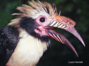 Photo from: https://ebonph.wordpress.com/2013/01/04/philippine-crocodile-conservation-in-isabela-province/
The mountain range covers a large part of the province of Aurora. In fact, apart from the Aurora coastline, the mountain range is where the flora and fauna of the province is concentrated. Waterfalls, rivers and crystal-clear streams of varying sizes are located within, if not adjacent to, the Sierra Madre Mountain Range. Activities such as mountain climbing, photo safaris, birdwatching, ecological studies, or simply picnicking could be rolled into one by taking trails recommended by local nature trekkers. Read More: http://www.localphilippines.com/attractions/sierra-madre-mountain
Description by UNESCO
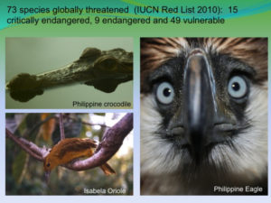 Photo from: https://ebonph.wordpress.com/2013/01/04/philippine-crocodile-conservation-in-isabela-province/
The Northern Sierra Madre Natural Park (NSMNP) is within the Sierra Madre Biogeographic Zone (SMBGZ) which lies along the eastern side of Central Luzon. The Northern Sierra Madre Natural Park (NSMNP) is one of the ten (10) priority protected areas in the country.
The Northern Sierra Madre Natural Park (NSMNP) is considered one of the most important of the protected areas system of the Philippines. It is the largest protected area in the country and the richest in terms of genetic, species and habitat diversity. The importance of the park is underscored by the myriad of rare and endangered species of flora and fauna that it supports. These include Philippine Eagle (Pithecophaga jefferyi ), Golden Crowned Flying Fox (Acerodon jubatus ), Philippine Eagle-Owl ( Bubo philippensis), Isabela Oriole (Oriolus isabellae ), Green Sea Turtle ( Chelonia mydas), Loggerhead Turtle ( Caretta caretta ), Hawksbill Turtle (Erethmochelys imbricata), Philippine Crocodile (Crocodylus mindorensis ) and Dugong ( Dugong dugon ).
The mountain range system provides the area for growth and development of unique habitats and their associated flora and fauna, e.g., grasslands to mountain forests, which is among the most unique and richest on a per area basis among the park systems in the Philippines. It is described as long mountain chain providing habitats for the numerous species of plants and animals adapted to various ecological niches.
The NSMNP is habitat to many endemic and rare species of plants. Among the endemic plants in the park are the various species of the dipterocarp family such as Shorea spp. and Hopea spp., various orchids such as Dendrobium aclinia, the leguminous tree, Milletia longipes and a member of the citrus family, Swinglea glutinosa. Read More: http://whc.unesco.org/en/tentativelists/5037/
Marikina-Infanta Highway
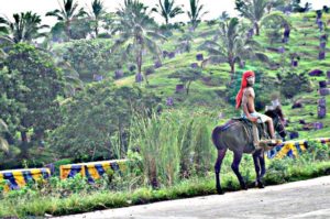 Photo from: http://booklangngbook.blogspot.com/2013/06/sierra-madre-real-quezon.html
Are you looking for unspoiled and breathtaking scenery within a few hours reach of Manila? Then the Sierra Madre Road or Marilaque Highway (Markina Rizal Laguna Quezon) from to Real, Quezon will be a great destination for you.
The Marikina-Infanta Highway is a scenic route ideal for mountain bikers, runners, avid tourists and motor bikers. You will really enjoy the breath taking view of mountain ranges and the cold weather of Sierra Madre. It has the same weather like the ones in Baguio. The long stretches of mountain ranges and virgin forest is awesome. This place is not commercialized with any residential subdivisions and posters and yet it is only a 2 hour drive from Metro Manila. Read More: http://booklangngbook.blogspot.com/2013/06/sierra-madre-real-quezon.html
Northern Sierra Madre National Park

Northern Sierra Madre Natural Park (Palanan Rainforest) The largest protected area in the country with more than 300,000 hectares of rainforest, and the lowest at 800 feet above sea level. Declared number one in biodiversity and also one of the top 10 biodiversity “hotspots” in the world. Read More: www.thebignm.net
Surfing Zone in Real Quezon
 Photo from: https://biyaherongbarat.com/2014/02/18/real-quezon-surfing-camping-vacation-at-the-park/
Conveniently located only 2-3 hours away from Rizal Province, passing by the picturesque Laguna Lake and through the scenic Sierra Madre Mountain Ranges, is the coastal town of Real, Quezon. Due to its proximity, my friends and I have been coming to this beach destination for quick and easy getaways such as this three-day surfing and camping vacation at The Pacific Recreation Kamp a.k.a. “The PaRK“.
The PaRK provides visitors with safe campgrounds covered in soft grass and shaded by trees, ideal for pitching tents or setting up hammocks. Campsite is equipped with a open cottages, cooking areas, a basic C.R., shower areas and there’s also a store. Thus, all basic needs can be found at The PaRK which makes your camping trip much easier and safer. Read More: https://biyaherongbarat.com/2014/02/18/real-quezon-surfing-camping-vacation-at-the-park/
Pantabangan Dam
 Photo from: mysmartschools.ph
Pantabangan Dam is an earth-fill embankment dam on the Pampanga River located in Pantabangan in Nueva Ecija province of the Philippines. The multi-purpose dam provides water for irrigation and hydroelectric power generation while its reservoir, Pantabangan Lake, affords flood control. The reservoir is considered one of the largest in Southeast Asia and also one of the cleanest in the Philippines. Construction on the dam began in 1971 and it was completed in 1977. Read More: wikipedia.org
Abuan River in Ilagan, Isabela
 Photo from: http://angsawariko.blogspot.com/2011/06/isabelas-abuan-river-is-philippines.html
Abuan River is located in Ilagan City, Isabela. It originates from the mountains in the Northern Sierra Madre National Park where one of the widest tropical rainforest in the Luzon can be found and is a major tributary of the Ilagan river. Read More: http://greedypeg.org/isabela/Abuan-River.html
Odessa-Tumbali Caves
 Photo from: https://greedypeg.org/cagayan/Odessa-Tumbali-Cave-Abbenditan-Cave.html
One of more than three hundred caves that are found in the province of Cagayan in the Philippines, the Odessa-Tumbali Cave System is recorded as the 3rd longest cave in the country that boasts of an astonishing length of at least 12.60 kilometers, where only about 7.65 kilometers of it is said to have been explored and mapped. However, its actual length may reach up to 15 kilometers. Read More: http://triptheislands.com/off-the-beaten-path/the-odessa-tumbali-cave-system-in-cagayan-province/
Dicotcotan Beach
 Photo from: topphilippinebeaches.blogspot.com
Dicotcotan Beach Resort boasts of a three-kilometer long beach with coral reefs, sea grass beds and sandy shoreline that is fringed with a coastal forest and a village. According to Reynante, there have been regular sightings here of pointed nosed dolphins and hump back whales, aside from the various species of fish and shellfish, and marine turtles that can be seen from the surface. If you are planning to stay here for a few days, there are available cottages for rent. Read More: http://thebestofisabela.blogspot.com/
Puray Falls in Montalban, Rizal
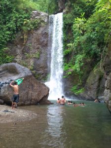 Photo from: http://montalbancyclingclub.blogspot.com/2014/01/puray-falls-newbie-ride.html
When we speak of Montalban, thoughts of Wawa come firsts. I wasn’t aware that there’s such a thing as Puray Falls in the vicinity of Rizal.
Barangay Puray is one of the most isolated areas in Montalban, Rizal and I didn’t know how the hell Elbert and our friend Azul discovered this place. Read More: http://weekendbiyahera.blogspot.com/2013/06/enroute-to-puray-falls.html
Gabaldon Falls
 Photo from: sosyalan.com
Gabaldon, Nueva Ecija is located at the foot of Sierra Madre near the Dingalan Bay,Aurora province. Gabaldon is a small town where lots of clean river from the cold water falls of Sierra Madre can be enjoy. The nearest water falls from the town proper is called Gabaldon Falls. Read More: philippinewaterfalls.blogspot.com
Callao Cave
 Photo from: http://www.visitmyphilippines.com/destinationdetails.php?trackId=82
The Callao Caves at Peñablanca, Province of Cagayan offers world-class caving adventures. Even the most experienced cavers would be awed by the unspoiled beauty of the limestone formations that are “hidden in the dark” subterranean natural structure. A unique adventure in the subterranean world. See spectacular rock formations or speleothems– stalactites and stalagmites: flowstones and glittering dripstones cave curtains: crystal helictites: columns, etc. Crawl, climb, dive or simply admire what is hidden in the dark. Top this with relaxing swim at Mororan while awaiting the spectacle of the circadian flight of bats. Read More: http://www.lakadpilipinas.com/2015/04/callao-cave-penablanca-cagayan.html
Palo Alto Falls in Baras, Rizal
 Photo from: http://shoestringtravelers.com/?q=node/99
The place is ideal for motorcyclists and road trippers who want to go swimming and have picnics during the weekends. By car or motorcycle, the drive takes about an hour or less from QC without traffic. For mountain bikers, it’s more of a challenge, with the uphill ascents, but at least they can relax and cool down after a tiring ride. The whole complex has very good paved roads and secure parking areas for all types of vehicles.
From the parking area, you have to climb up 249 concrete steps to get to the foot of Palo Alto Falls, which is 1000 feet up. It sounds daunting at first, but really, it takes just about 5-8 minutes to get to the foot of the falls. Along the way, you’ll pass through thick forests beside a small stream, with water trickling down through the rocks. It’s very serene and peaceful, especially if you’re the only one there. Read More: http://www.traveling-up.com/palo-alto-falls-leisure-park-in-baras-rizal/
Dicasalarin Cove

Dicasalarin Cove in Baler, Aurora province (Luzon, northern Philippines) is a secluded white sand beach where the verdant Sierra Madre foothills meet the Pacific Ocean (Source: Waypoint). Dark, thickly forested hills contrast with the striking white shoreline.
There are no resorts and visitor facilities on this fine stretch of sand. A freshwater river, flowing from the mountains beyond, trickles out to the sea. Dicasalarin Cove’s stunning, rugged beauty and relative isolation certainly make it one of Baler’s best-kept secrets. Read More: https://365greatpinoystuff.wordpress.com/2010/05/30/150-dicasalarin-cove/
Mt. Daraitan in Nakar, Quezon
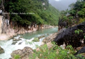
Photo from: https://darwinfdalisay.wordpress.com/2015/08/02/mt-daraitan/
Want nature tripping with exciting activities? Mt. Daraitan is perfect for you. This is one of the prides of Rizal and considered as a paradise near Manila. It is situated in and a boundary of Rizal and General Nakar, Quezon. Daraitan is one of the logging areas in the province, but was converted to a paradise for people with extreme trip. This mountain is a small part in Sierra Madre Ranges: so it has spring, waterfalls, limestone formations, natural pools and rich in flora and fauna. Read More: https://darwinfdalisay.wordpress.com/2015/08/02/mt-daraitan/
Costa Pacifica Raintree
 Photo from: http://www.matetreyes.com/2013/09/baler-bound-sweet-rendezvous-at-costa.html
Costa Pacifica Raintree in Baler, Aurora, Philippines is located along Sabang Beach, which attracts surfers from November to March. Water sports enthusiasts can also enjoy Cemento Reef, Dicasalarin Point, Charlie’s Point, and Dalugan Bay. Aside from geographic formations, hiking trails, waterfalls, and coves, Baler is home the historic Museo de Baler and Dona Aurora’s House, which are just a few minutes away from the hotel’s location. Read More: http://triptheislands.com/accomodation/aurora-comes-alive-with-costa-pacifica-raintree-resort/
Daranak Falls
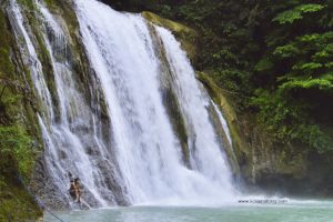 Photo from: http://www.kirkanatomy.com/2014/05/quick-guide-daranak-falls-in-tanay-rizal.html
The nearby province of Rizal in eastern Metro Manila is fast becoming a popular destination for day trippers and nature lovers. This is because the province is home to amazing natural wonders including some of the country’s beautiful and easily accessible waterfalls.
In the town of Tanay alone, there are numerous waterfalls perched on the mountainside of Sierra Madre Mountain Range such as Daranak Falls in Barangay Tandang Kutyo.
Sitting in a government-owned land, Daranak Falls’ main attraction is the 14-meter high waterfalls cascading into a deep catch basin that serves as its natural pool. This is aside from other smaller waterfalls situated in the area including the one across with cold and strong water freely flowing through the boulders into the same catch basin, perfect for a natural water massage. Read More: http://www.lakwatsero.com/spots/daranak-falls-of-tanay-rizal/
Mt. Palali
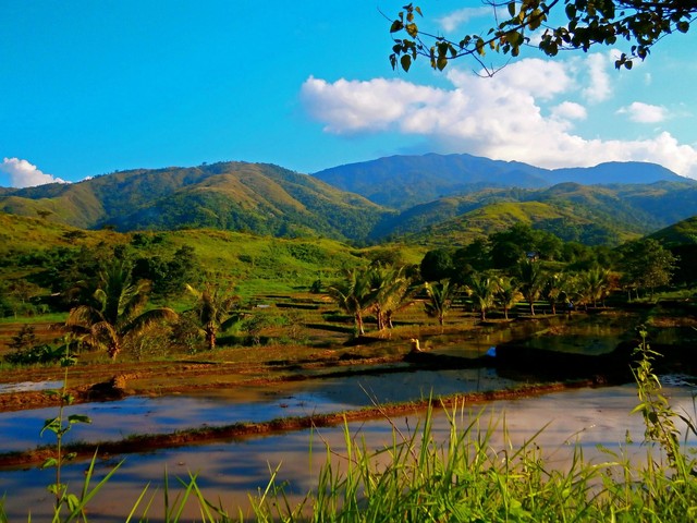 Photo from: http://philippinevolcanoes.blogspot.com/2017/03/mt-palali-in-nueva-vizcaya.html
A little-known but very beautiful destination in Northern Luzon is Mt. Palali in Nueva Vizcaya. Once the hunting ground of the Bugkalots, Gaddangs, and Ifugaos, this majestic mountain offers a commanding view of the low-lying municipalities of the province. Read More: pinoymountaineer.com
Batlag Falls
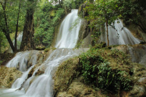 Photo from: http://insights.looloo.com/rizal-one-province-near-manila-that-has-it-all/
Further up from Daranak Falls is its sister upstream, Batlag Falls. Set in a dense forest, with nearby tables and cottages, this waterfall is set on a unique rock formation, with the water following its unpredictable contours. This departure from the conventional picture of a waterfall, coupled with its more serene setting, makes Batlag Falls a sight to behold. Read More: http://www.pinoymountaineer.com/2007/09/batlag-falls.html
Dibulo Falls
 Photo from: philippinewaterfalls.blogspot.com
A hidden, majestic waterfalls with an enchanting beauty. Dibulo Falls is gaining popularity because of its suspended features.
When visiting the province of Aurora and you have the guts to stretch your exploration to reach the farthest and northernmost part which is the town of Dilasag, there is a natural wonder you need not miss to see. It is the wonderful Dibulo Falls.
Dibulo Falls is the tallest waterfalls in the Province of Isabela located in the little town of Dinapigue — the only secluded part of Isabela province. It is located on the eastern coast side of the province facing the Pacific Ocean. Being separated by the mountain ranges of Sierra Madre from the rest of the province, the only access road going to the small town is via Dilasag, Aurora, where one has to ride an off-road vehicle due to the bumpy zig-zag roads. From Santiago City, you can also take a Dinapigue-bound mini bus that takes 12-14 hours to reach the town. Read More: http://www.psst.ph/dibulo-falls-waterfalls-isabela/
Pampanga River
 Photo from: https://ebonph.wordpress.com/2012/04/01/new-birding-site-near-manila-bangkong-malapad/
Pampanga River (also known as Rio Grande de Pampanga – Great River of Pampanga) is the second largest river in the island of Luzon, next to Cagayan River and the third largest but most important river in the Philippines. It is also the fourth longest river in the Philippines next to Agusan River and Mindanao River. It is located in the Central Luzon region and traverses the provinces of Pampanga, Bulacan, and Nueva Ecija.
Its headwaters are located at the Sierra Madre and runs a south and southwesterly course for about 260 kilometers until it drains into Manila Bay. Read More: https://www.revolvy.com/main/index.php?s=Pampanga%20River&item_type=topic
Ditumabo Falls
 Photo from: pusangkalye.net
Ditumabo Falls is located in Brgy Ditumabo, San Luis which is about 30 minute drive from Costa Pacifica Resort in Baler. It is one of the major attractions when visiting Baler.
Read More: http://driftwoodjourneys.com/ditumabo-falls-mother-falls-sanluis-aurora/
Kinabuan Falls
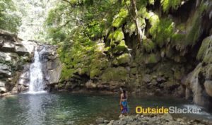 Photo from: http://www.outsideslacker.com/biking-to-kinabuan-falls-and-meeting-the-dumagats/
Kinabuan Falls in Sta. Ines, Tanay Rizal used to be just a side trip for hikers and mountaineers climbing Sierra Madre’s Mt. Irid. Recently though, it has also become a popular destination for Metro Manila mountain bikers seeking to cool off in a body of water that’s not as crowded as Daranak, Batlag or Puray. Unlike these other waterfalls that are now often crowded with noisy barkadas, Kinabuan still has that rustic frontier charm that many of the more touristy waterfalls have lost. Because it isn’t easy to get to, Kinabuan hardly sees any crowds.
Kinabuan is also home to a community of Dumagats–indigenous peoples who call the Sierra Madre their home. Like the Aetas of Central Luzon, the Dumagats live on the margins of society, and eke out a living with subsistence farming and hunting. Read More: http://www.outsideslacker.com/biking-to-kinabuan-falls-and-meeting-the-dumagats/
Angat Dam
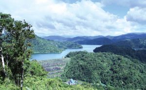 Photo from: https://news.mb.com.ph/2016/11/13/phase-ii-of-angat-dam-rehab-begins/
Angat Dam is a concrete water reservoir embankment hydroelectric dam that supplies the Manila metropolitan area water. It was a part of the Angat-Ipo-La Mesa water system. The reservoir supplies about 90 percent of raw water requirements for Metro Manila through the facilities of the Metropolitan Waterworks and Sewerage System and it irrigates about 28,000 hectares of farmland in the provinces of Bulacan and Pampanga. – Read More: wikipedia.org
Cagayan River
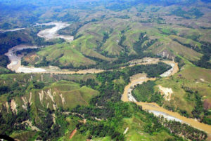 Photo from: http://backpackerlifestyles.blogspot.com/2016/04/cagayan-river-longest-and-largest-river.html
The Cagayan River is the longest and largest river in the Philippine Archipelago. It is located in the Cagayan Valley region in northeastern part of Luzon island and traverses the provinces of Nueva Vizcaya, Quirino, Isabela and Cagayan.
The river’s headwaters are at the Caraballo Mountains of the Central Luzon at an elevation of approximately 1,524 meters. The river flows north for some 505 kilometersto its mouth at the Babuyan Channel near the town of Aparri, Cagayan. The river drops rapidly to 91 meters above sea level some 227 kilometers from the river mouth. Its principal tributaries are the Chico, Siffu, Mallig, Magat and Ilagan Rivers. Read More: https://rlbalmaceda.wordpress.com/2011/05/27/cagayan-river-longest-river-in-the-philippines/
Sangab Underground River and Cave
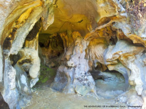 Photo from: https://margamaefavor.wordpress.com/2015/02/21/tanay-your-adventure-destination/
Sangab Cave is within a private property located on the opposite side of the river which hikers ought to cross after the ricefield at the initial stages of the hike. The flowing water, which is also very clear, is really very cold. The water overflows freely into the river. Sangab Cave has a small opening but according to VIR, the explored portions of the cave is actually a 15-minute hike. Supposedly, there are also stalactites and stalagmites inside Sangab Cave. Read More: http://skookummountaineers.blogspot.com/2015/04/mt-batolusong-duhatan-ridge-mapatag.html
TABLE OF CONTENTS
Sierra Madre – Philippines’ Longest Mountain Range
Where is Sierra Madre and How To Get There
Attractions in and Around Sierra Madre
Fun Activities To Do Around Sierra Madre
Sierra Madre Video Collections
Other Visitors Also Viewed:
Palani Beach Boasts of a 10 Km-Long White Sand Beach
San Isidro Labrador / Pahiyas Festival in Quezon
Colorful and Exciting Festivals in Nueva Ecija
Top Tourist Destinations in Aklan
Embajada Festival – a Re-Enactment of Christianization
Bird Watching at the Olango Wildlife Sanctuary
The Small Paradise in Agho Island in Iloilo
Sugbo Festival Honors the Humble Tiger Grass
Kabila / Kibila White Beach is Famous for Diving and Snorkeling
The Unspoiled Beauty of Aroroy Beach
Aurora Is Host to Philippine Surfing Cups