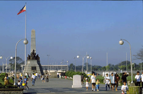
8 Reasons A Trip to the Philippines Should Be In Your Future
by Huffington Post

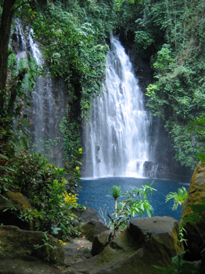
Amazing Waterfalls in the Philippines
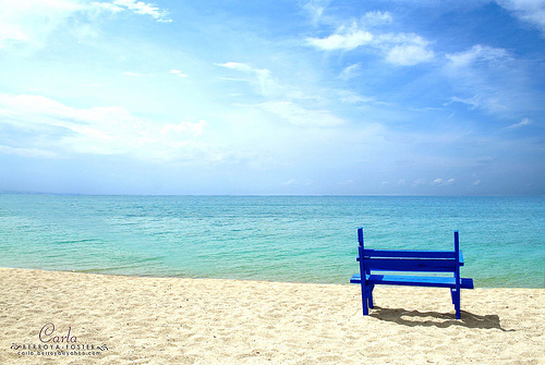
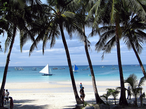
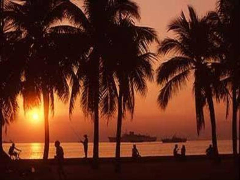
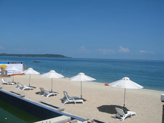
Magnificent Beaches in the Philippines
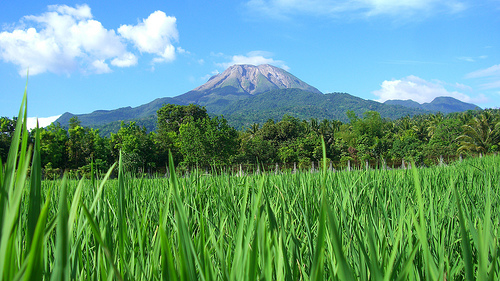
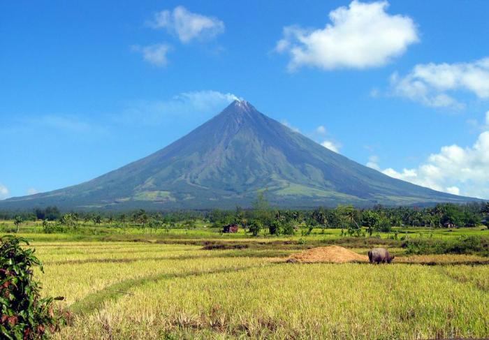
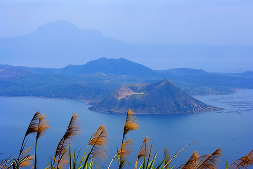
Breathtaking Volcanoes in the Philippines
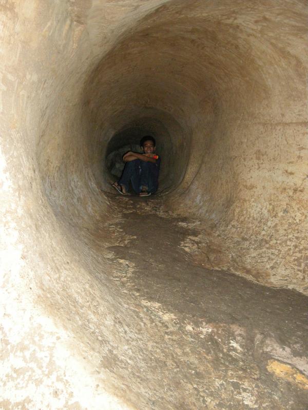
Awesome Caves in the Philippines
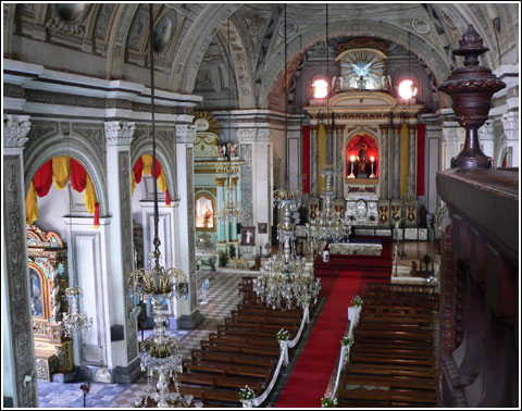
Grand Churches in the Philippines
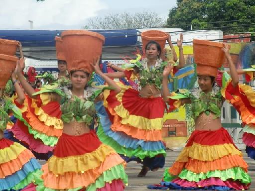
Colorful and Meaningful Festivals in the Philippines

see more pictures and
videos of the Philippines!

CAGAYAN WATERS
Shapely mountain ranges within land-locked areas, riveting labyrinths of multi chambered caves, lush virgin forests with awesome flora and fauna, pristine coastlines and prolific outskirt seascapes make Cagayan one of the best places in the world for spelunking, trekking and game fishing.
Cagayan River (Rio Grande de Cagayan)

The Cagayan River is the longest and largest river in the Philippine Archipelago. It is located in the Cagayan Valley region in northeastern part of Luzon island and traverses the provinces of Nueva Vizcaya, Quirino, Isabela and Cagayan.
The Cagayan River and its tributaries are subject to extensive flooding during the monsoon season in Southeast Asia from May to October.
The average annual rainfall in 1,000 mm in the northern part and 3,000 mm in the southern mountains where the river’s headwaters lie. Water from the mountains flow down very slowly because of surface retention over the extensive flood plain, the gorges in the gently-sloping mountains and the meandering course of the river. Read More: https://backpackerlifestyles.blogspot.com/2016/04/cagayan-river-longest-and-largest-river.html
Claveria Coast
 Photo from: http://www.suroypilipinas.com/2013/03/sentinela-beach-cove-claveria-cagayan.html
Claveria Coast is the “The Coastal Paradise of the Cagayan North”.
Sta. Ana Beaches

Sta. Ana Beaches – from pristine blue waters and fine sand, to rolling hills and enchanting colonial structures, to mystical caves and endearing people. It is dubbed as “Untouched Paradise”, “Gateway to the Pacific”, “Game Fishing Mecca”, “Luzon’s Last Frontier” and “Marine Sanctuary”.
Sta. Ana – Anguib Beach
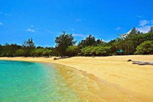 Photo from: https://nicerioadventures.blogspot.com/2014/06/featured-destination-anguib-beach.html
Anguib Beach is deemed as the “Boracay of the North” as it is known for its white sand beach and picturesque sceneries — which makes it comparable to Boracay – One of the Worlds Best Beach Destination. The beach is surrounded by small mountains which make it even more majestic. This beautiful place is seated in Barangay San Vicente in the town of Sta. Ana. Read More: https://outoftownblog.com/visit-sta-ana-cagayan-a-town-where-you-can-find-the-boracay-of-the-north/
Sta. Ana – Nangaramoan Beach
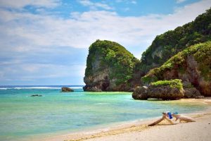 Photo from: https://500px.com/photo/7120376/nangaramoan-beach-by-florante-bautista
Sta. Ana – Pozo Rovo Beach
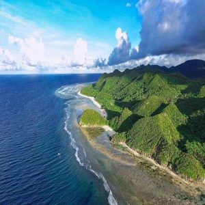 Photo from: http://www.cagayan.gov.ph/tourism-attractions/pozo-robo-beach-santa-ana/
Though this place is restricted (shooting of Survivor USA), we still tried to dock here, but it was not long before a security guard approached us. But we still managed to successfully persuade him. He allowed us to stay long, but told us not to turn on the boat’s engine. No wonder why the island was chosen: this place is beautiful and pristine. The white sands carpeted the entire beach and has formations similar to a snake path (similar to what can be seen in the desert). This beach is different because during low tide, several pools of water of varying depths are left behind at parts of the beach which can be used for bathing. At its side are forests that are part of Sierra Madre. Too bad we weren’t unable to explore it further for we might be apprehended, so we decided to go back. Read More: http://www.tupanggala.com/santa-ana-beach/
Chico River
 Photo from: travel-philippines.com
The Chico River is a river system in the Philippines in the island of Luzon, encompassing the regions of Cordillera and Cagayan Valley. It is the longest tributary of Cagayan River.
The most extensive river in the Cordillera region, it covers the provinces of Mountain Province, Kalinga and Cagayan. It is referred to as a “river of life” for the Kalinga people who live on its banks, and is well known among development workers because of the Chico River Dam Project, an electric power generation project which local residents resisted for three decades before it was finally shelved in the 1980s – a landmark case study concerning ancestral domain issues in the Philippines. Read More: https://en.wikipedia.org/wiki/Chico_River_(Philippines)
Baggao Bluewater Falls and Cave
 Photo from: choosephils.com
Never did I see a place as mysterious and magnificent as the Blue Water Cave and Falls. It is totally amazing! The cascading blue water from the cave entrance, the rocks that are masquerading in the vicinity, the trees that surrounds us, the sounds of birds and crickets – everything is just perfect. Enchanting. Captivating. I know there is a reason why this place was delicately placed far north of Tuguegarao, so it can somehow escape the abusive changes that modernization and civilization could bring. Read More: cagayanvalley.com
Lakay-Lakay Lagoon

The famous natural monument of Lakay-Lakay Lagoon is a mountain islet in the western end of Claveria Beach. It is obviously detached from the mainland by just a few meters – most probably the works of erosion done by breaking waves on the mountain’s rocky sea cliff making it a jutting rock monument in the sea horizon that adds beauty to the landscape on sunsets.
Cabicungan River

Cabicungan River adds up the view as it is a snake that stretched along the middle of the field and at the base of the mountain dividing Cagayan and Apayao provinces. Cabicungan River is a hydro-graphic stream located in Claveria, Cagayan. It stretches and dumps the fresh water to Claveria Bay. People living near the river are fishermen and mostly farmers. The stream serves as an irrigation to the rice fields. Also, it is a great place to have picnics especially during the summer.
Fuga Island

A natural wonder, Fuga Island captivates tourists with a penchant for ancient history and traditional culture.
Saddle up and roam around every corner of the island on a horse and enjoy the beautiful gorges. Explore the tunnel-cave and see if you can find gold bars and old jars as said in the treasure tales. Rest and relax on its endless white sand and pink coral beaches. Pick the little octopuses you can find on the shore or snorkel in its shallow, clear waters and look for colorful fish. Dive into its pristine waters and explore the diverse marine life teeming with rare species of fish and giant turtles. Swim and listen closely to them. Read More: http://bestphilippinebeaches.com/fuga-island-a-natural-wonder
Portabaga Falls
 Photo from: photos.ferdzdecena.com
Portabaga Falls is one of 2 well-known falls in Sta. Praxedes, the other being Macatel Falls. About a hundred meters from the main highway, Portabaga Falls is known as one of the notable sights of Cagayan, being one of the tallest in the entire Cagayan province. About 15 meters or 41 feet high, the waterfall has 3 drop-off points. At the bottom of the falls is a huge catch basin that was constructed for swimming. Read More: https://theprovinceofcagayan.wordpress.com/portaboga-falls/
Macatel Falls

Macatel Falls has crystal waters that run in abundance throughout the year. There are nipa cottages on the banks for day-tour visitors. A well-placed big flat rock on the left side is a favorite diving platform for those who dare to dive 8m high down to the 6m deep basin formed at the base of the falls. The basin is wide enough to do some backstroke/freestyle swimming from end to end.
At the top of the falls is a small basin 2m deep. The flowing water into this small basin sculptured a natural slide on the rock. Great fun sliding and get submerged in the bubbling water. Many shallow natural bathtubs around can be a safe and fun place for the kids.
Calayan Island

Calayan Island is the island-town which is only a two-hour boat ride from Aparri. It is rich in natural attractions like excellent beaches, archeological sites, endemic flora and fauna, virgin forest, crystal clear blue waters, plus the hospitable and gentle people with colorful history. It is one of the Babuyan Islands in the Luzon Strait north of Luzon Island and is home to the Calayan Rail, a flightless bird identified as a separate species in 2004. Calayan Island is sought after for whale watching.
Palaui Island

White sandy beaches and coves, a century old lighthouse, hidden waterfalls and lovely people, all in a scenic ragged terrain surrounded by howling wind and huge waves, that is Palaui Island.
With a land area of more than 3000 hectares, Palaui, an island made up of volcanic debris, is politically under the jurisdiction of the town of Sta. Ana. It is home to a fishing community, without electricity and commercial accommodation. Its main attraction aside from its beaches is the Farol de Cabo Engaño, an 18th century lighthouse built by the Spaniards that guides ships entering and leaving the coastal towns of Sta. Ana specially those vessels using Port Irene and San Vicente Port, and those traversing the Babuyan Channel and Philippine Sea.
Fall in love in a place built by wind and waves, and nurtured by time; discover the distinct charm of its scenic ragged terrain; sing with the howling sound of its gigantic waves. Discover, explore and experience Palaui Island. Palaui Island is famous for scuba diving, snorkeling and fishing.
Gotan Island
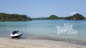 Photo from: http://www.travextravels.com/2017/07/gotan-beach-sta-ana-cagayan.html
Sibang Cove
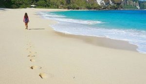 Photo from: http://visitpinas.com/sibang-cove-calayan-island-photo-of-the-day/
Sibang Cove, with its high walls of rocks, offers adventure tourism even as one lazes on fine white sand. The cove also features rock formations that dot the shoreline and green and clear seawaters to dive into. Read More: https://www.rappler.com/life-and-style/travel/ph-travel/169743-calayan-island-beaches-photos
Kangaroo Beach
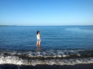 Photo from: https://www.pinterest.com/pin/197595502377174536/
Siwangag Cove
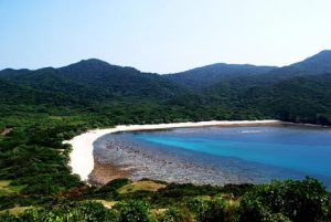 Photo from:
Siwangag Beach is part of Engano Cove southwest of the lighthouse where supplies for the station were previously landed.
Today, small vessels can find good anchorage in this protected cove, except by northwesterly and westerly winds. A trail and a 229-step concrete stairway from the cove leads the travelers to the lighthouse.
The Port of San Vicente in Santa Ana, Cagayan, situated between Palaui Island and the coast of Luzon, is the jump-off point for crossing the channel to Punta Verde (Point Verde) on Palaui Island, or heading to Engaño Cove, a little further to the north.
The hike from Punta Verde, the southeast tip of Palaui, to Cape Engaño takes about 3.5 hours of hiking through beautiful verdant scenery. Primitive camping is allowed at the lighthouse vicinity. Read More: https://greedypeg.org/cagayan/Siwangag-Cove-and-Beach.html
Dos Hermanas
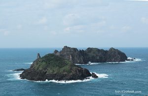 Photo from: http://travelhabeat.com/cagayan-island-hopping/
TABLE OF CONTENTS
Where is Cagayan and How to Get There
Cagayan – The Land of Smiling Beauty
Magnificent Beaches and Bodies of Water in Cagayan
Other Visitors Also Viewed:
Take the Day Off and Relax at the Minalungao National Park in Nueva Ecija
Beaches in Matabungkay, Batangas
Top Tourist Attractions in Davao del Norte Part 6
Whale Shark Watching in Donsol, Sorsogon
Catanduanes, Typhoon and Crab Capital of the Philippines
Samba de Regatta Music and Dance Event of Iloilo Paraw Regatta
Baler in Aurora – Scene of film “Apocalypse Now”
Itbog Twin Falls Offer Double Fun and Enjoyment